About the Mitchell water plan area
The Mitchell water plan supports the water needs of several urban and regional centres including Kowanyama and Chillagoe. Town water supply is mostly sourced from groundwater bores, with some areas relying on the Great Artesian Basin aquifers, which is mostly managed under the Great Artesian Basin and other regional aquifers (GABORA) water plan 2017.
Water in this area also supports small-scale irrigation and small mining operations and is also used for social, economic or cultural purposes including recreational activities, commercial fisheries, and a growing tourism industry.
An emerging industry in the area is the production of critical minerals, such as of copper, tungsten, antimony and zinc. Current and potential future expansions of mining these and other rare earth minerals require water.
The water plan makes sure any development of new water infrastructure is done in an ecologically sustainable way. This protects the important environmental processes, ecological needs (for plants and animals) and heritage values that exist in the water plan area.
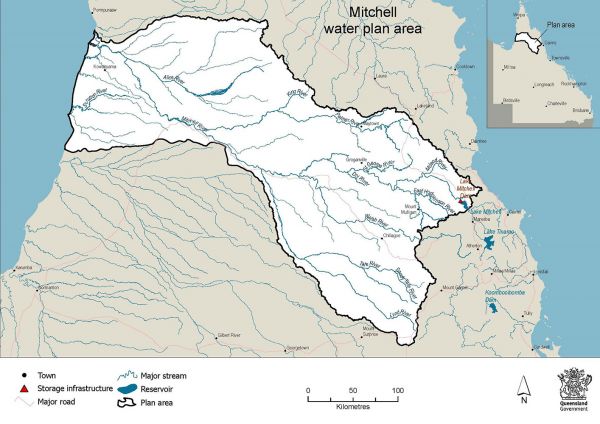
The plan area
The Mitchell water plan area covers approximately 72,000km2 in Far North Queensland and includes major rivers such as the Mitchell, Walsh, Palmer, and Lynd.
The water plan borders the Cape York, Wet Tropics, Barron, and Gulf water plan areas.
Explore the water plan area and its surrounding water plan areas via the Queensland Globe water plan map (use Google Chrome for best results).
We don’t intend to expand the water plan area or amalgamate this water plan with any other water plan areas.