
About the Warrego, Paroo, Bulloo and Nebine water plan area
Water is very important to communities in the Warrego, Paroo, Bulloo and Nebine water plan area—for stock and domestic use, the environment and some irrigation. The region faces challenges such as extreme flooding and prolonged droughts. Healthy water systems support industries such as tourism, including eco-tourism and recreational activities like birdwatching and fishing.
The Warrego, Paroo, and Nebine catchments form part of the Murray-Darling Basin. Their rivers flow into the intersecting streams in New South Wales, connecting to the Barwon-Darling system.
The Bulloo River flows inland to the Bulloo Lakes in Queensland. The Bulloo catchment is a terminal system, meaning it is not connected to either the Murray-Darling Basin or Lake Eyre Basin.
The Paroo River supports diverse flora and fauna and the Currawinya Lakes Ramsar-listed wetland area. Across the region, wetlands and floodplains rely on natural water flows to sustain these ecosystems and their biodiversity.
There is groundwater in the plan area including the Great Artesian Basin. The Great Artesian Basin is managed under a separate water plan.
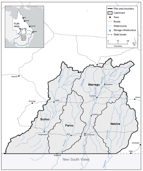
Map of the Warrego, Paroo, Bulloo and Nebine water plan area
Explore the water plan area and its surrounding water plan areas using the Queensland Globe water plan map (use Google Chrome for best results).