About the Whitsunday water plan area
The Whitsunday water plan supports the water needs of regional centres including Proserpine, Airlie Beach, Bowen and the surrounding areas.
Water in the region is used for social, economic or cultural purposes including tourism, agriculture, mining, aquaculture and supports growing communities and towns. Expanding existing industries and new or emerging industries in the region, will have impacts for water needs and use.
The water plan also makes sure any development of new water infrastructure is done in an ecologically sustainable way. This protects the important environmental processes, ecological needs (for plants and animals) and heritage values that exist in the water plan area.
Proposal to expand the Whitsunday water plan area
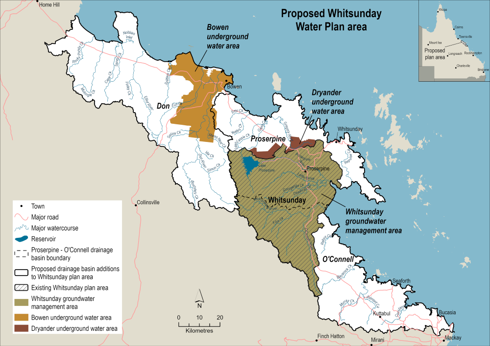
We are proposing to expand the Whitsunday water plan area to combine the original water plan area with 3 coastal basins:
- the Don Basin
- the northern area of the Proserpine Basin
- the southern area of the O’Connell Basin.
This proposal would bring these 3 adjacent coastal areas into Queensland’s water planning framework, and would also include the Bowen and Dryander underground water areas. The proposed new water plan would border the Burdekin Basin water plan and the Pioneer Valley water plan.
As part of the proposal we will consider what types of water licences are required and what new or additional strategies can be implemented.
Map showing the Whitsunday water plan area
Explore the water plan area and its surrounding water plan areas via the Queensland Globe water plan map (use Google Chrome for best results).
Coastal basins
The 3 coastal basins surrounding the current Whitsunday water plan are the Don, the northern area of the Proserpine and southern area of the O’Connell basins.
The Don Basin covers an area of 3,745km2 and sits north of the current water plan area. Regional centres in the basin include Bowen, Inkerman, and Gumlu, with Bowen also sitting on the only groundwater management area in the basin. The Bowen Underground Water Area is managed under the Water Regulation 2016. The main uses for water in the Don Basin are agricultural (grazing and crop irrigation), industry, recreation, and tourism.
The northern Proserpine Basin sits above the Whitsunday water plan and is the part of the Proserpine Basin not currently included in a water plan area. It includes the Dryander Underground Water Area which is managed under the Water Regulation 2016.
The southern O’Connell Basin sitting below the Whitsunday water plan is not currently included in a water plan area. It spans approximately 2,388km2 and covers regional centres including Midge Point, Calen, St Helens Beach, and Kuttabul. The main uses for water in the area are agricultural (grazing and crop irrigation), recreation, and tourism.