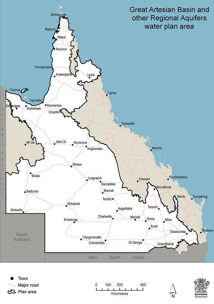
About the GABORA water plan area
The Great Artesian Basin and other regional aquifers (GABORA) water plan area covers the entire Queensland Great Artesian Basin (GAB) as well as other significant regional (non-GAB) aquifers from the Bowen, Galilee, Laura and Karumba basins. The plan regulates water associated with GABORA aquifers and connected springs.
This water is used for a variety of purposes, with stock and domestic use being the most widespread:
- about 85 Queensland towns including Toowoomba, Roma, Charleville, Winton, Julia Creek and Birdsville rely on the GAB for town water supply
- several major industries of significance to the Queensland economy rely on GABORA water, including irrigated agriculture, resources (mining, petroleum and gas), stock intensive (feedlots), industrial and commercial uses and tourism.
The plan area
The GABORA water plan area covers approximately 1,222,888km2. It is a complex, geographically extensive area comprising multiple aquifers with several geological basins and sub-basins that covers most of inland Queensland west of the Great Dividing Range and stretches from the tip of Cape York to the Queensland border in the south and west.
To effectively manage water in the GABORA water plan area, basin and aquifer boundaries were grouped and characterised into 49 discrete management units comprising 16 groundwater units, 9 of which are further divided into 42 sub-areas. Three 'zones' have been declared within the Hutton, Precipice and Springbok Walloon groundwater units where further limitations apply.

Map showing the GABORA water plan area
Explore the water plan area, its groundwater units, sub-areas and zones via the Queensland Globe water plan map (use Google Chrome for best results).
The GABORA water plan sets the rules to sustainably manage the allocation and taking of groundwater and water in springs associated with the groundwater units defined in the plan.
Other water, including groundwater in aquifers and springs not connected to the GAB is managed through overlying catchment plans, i.e. Burnett Basin water plan, through the Water Regulation 2016 or else not managed.