SEEBASE study and GIS data package
In 2018, under the Queensland Government's Strategic Resources Exploration Program, the Geological Survey of Queensland conducted a study using the SEEBASE® methodology.
The aim was to enhance the subsurface knowledge of frontier basins covering about 400,000km2 in north-west and central Queensland.
Data and reports
North West Basins final report and GIS data has geological modelling and data for the north-west Queensland's South Nicholson Basin, Isa Superbasin and Georgina Basin and central Queensland's Adavale Basin and Warrabin Trough.
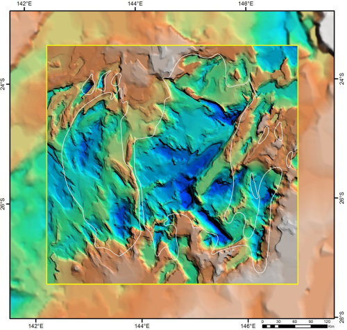
Central Basins final report and GIS data has an interpretation of basement terranes, fault maps, crustal composition and heat flow as well as maps of the depth-to-basement, depth-to-Moho, basement thickness and total sediment thickness.
Industry benefits
The north-west and central Queensland basins in the study have known petroleum systems and potential for gas and oil but are generally underexplored.
The new datasets provide an enhanced view of the basins' structural and basement framework.
This provides explorers with a valuable tool for planning future exploration programs with the potential to supply gas to domestic and export markets.
About the survey
The SEEBASE study and GIS data package were produced with the following objectives:
- improving the resolution of the SEEBASE model which defines depth to economic basement, based on available geophysical and geological datasets
- assessing basement geology and structural evolution
- interpreting basement terranes and their extent and nature at depth
- interpreting basement fault maps for key tectonic events
- interpreting basement composition
- developing a model for basement-derived heat flow
- producing a map of depth-to-basement (SEEBASE map), depth-to-Moho, basement thickness, total sediment thickness.

New SEEBASE map of central Queensland study area with the existing SEEBASE map in the background
Also consider…
- Visit the GSQ Open Data Portal to access other GSQ projects, reports and data.